Segment 6
Toll 49 Segment 6 Presentation
Toll 49 Segment 6 Presentation Exhibit Boards
Toll 49 Segment 6 Environmental Constraints Exhibit Board
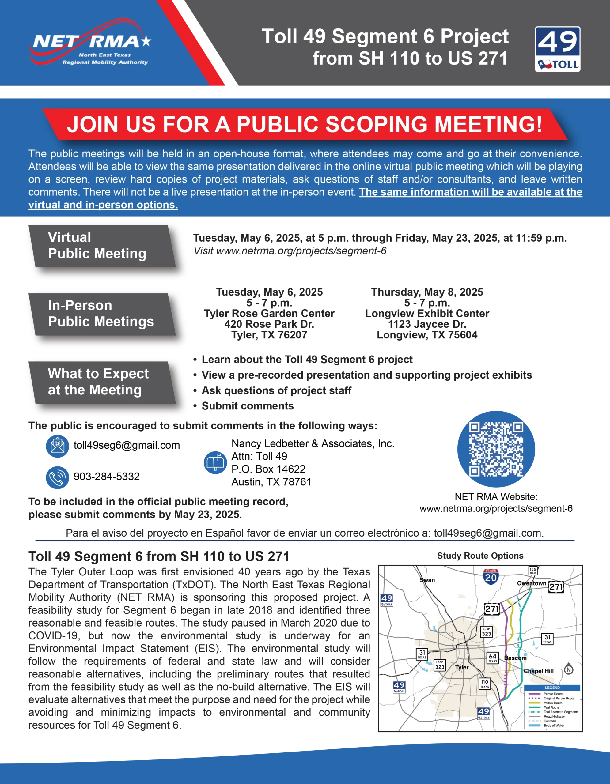
Toll 49 Segment 6 Fact Sheet
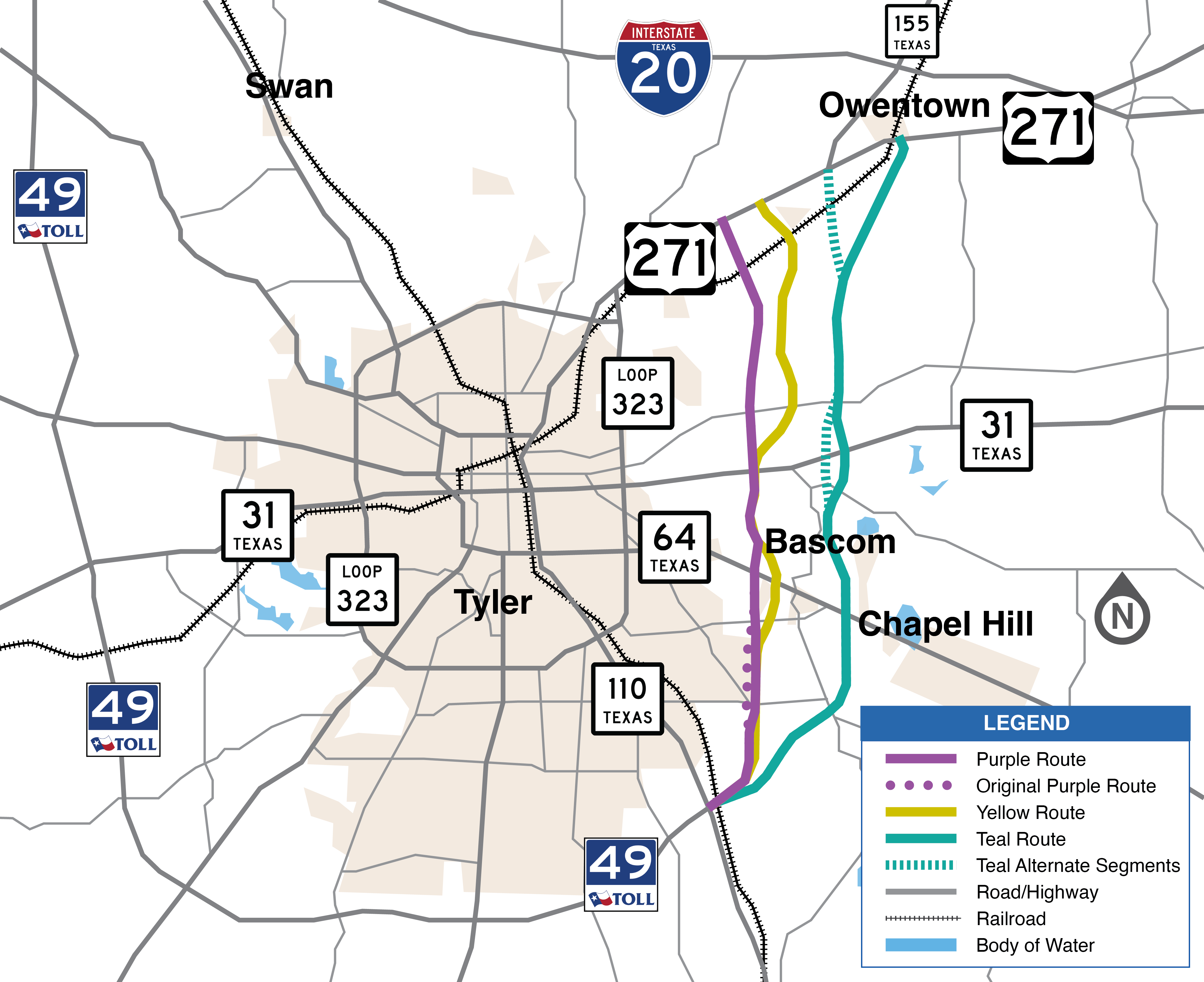
Toll 49 Segment 6 Detailed Map (Updated with CR Labels 5/15/25)
Toll 49 Segment 6 Feasibility Study
Toll 49 Segment 6 Feasibility Study Report Addendum
Toll 49 Segment 6 Public Involvement Plan (NEW 5/19/25)
Toll 49 Segment 6 Draft Purpose and Need (NEW 5/19/25)
Toll 49 Segment 6 Draft Coordination Plan (NEW 5/19/25)
Contact us here:


Segment 6
April 15, 2025 Update: After pausing in 2020 due to COVID 19, the proposed Toll 49 Segment 6 Environmental Impact Statement has resumed. A detailed environmental study will begin to look at the potential social and environmental impacts – and mitigation efforts to reduce those potential impacts for the three possible routes previously identified. The study will also consider a No-Build option in which the roadway will not be constructed.
GOOGLE EARTH
The project team has plotted the current route options under study on Google Earth to give the public a closer look. You will need to install the free Google Earth software on your computer in order to use this tool. Click here to download Google Earth . Use the link below to access and download the KMZ file.
CLICK HERE: Google Earth (KMZ) File (dated April 15, 2025)